Electronic City Connectivity
Electronic City is one of Bangalore's largest tech hubs, home to over 200 IT campuses. Whether you're commuting daily, visiting friends, or making deliveries, understanding how to reach Electronic City—by road, metro, rail, bus, or air—makes every trip smoother. This guide breaks down each mode of transport in clear steps.
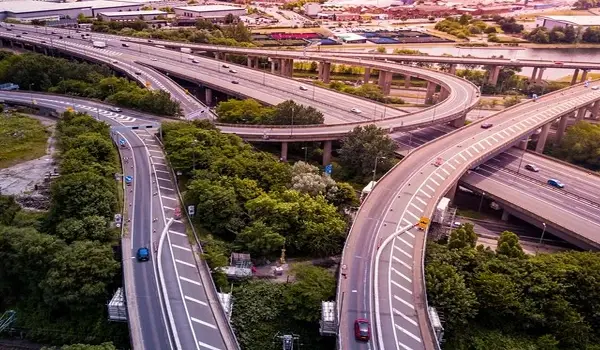
Electronic City sits on Hosur Road, officially National Highway 44 (NH 44). This wide, well-maintained highway links South Bangalore directly to Electronic City:
- From Silk Board Junction: 9 km southwest via NH 44.
- From MG Road: 18 km south-southeast along NH 44.
- From KR Market: 18 km via Silk Board and NH 44.
The Electronic City Elevated Expressway is a 9.985 km four-lane corridor from Silk Board to Electronic City Phase 1. Opened in January 2010, it cuts travel time by up to 50%—you can drive from Silk Board to Wipro Gate in about 30 minutes (toll applicable).
The NICE (Nandi Infrastructure Corridor Enterprises) Road is a 63 km, four-lane controlled-access tollway skirting western Bangalore. It connects Electronic City to:
- Bannerghatta Road
- Mysore Road
- Kanakapura Road
- Tumkur Road
Using NICE cuts cross-city trips by avoiding inner-city traffic.
The Outer Ring Road links the Northern and Eastern suburbs to South Bangalore. By taking ORR to Silk Board, then NH 44 or the Elevated Expressway, you can reach Electronic City from:
- Hebbal: 35–40 km (1–1.5 hrs).
- Whitefield: 24 km via ORR East (45 min).
Electronic City will soon gain its metro station on the Yellow Line (Rashtreeya Vidyalaya Road ↔ Bommasandra):
- Station Name: Electronic City Metro Station (Phase 1, PIN 560100)
- Opening: Expected July 2025.
- Key Stops Nearby: Konappana Agrahara, Bommasandra, RV Road (interchange with Green Line).
Once operational, the metro will offer a fast, air-conditioned alternative to road travel.
The South Western Railway runs suburban DMU (Diesel Multiple Unit) trains on the Bangalore Commuter Rail network:
- Nearest Station: Heelalige Railway Station
- Distance to Electronic City: ~6 km (11 min drive).
- Other Station: Carmelaram (14 km away) for select long-distance trains.
From Heelalige, BMTC buses and auto-rickshaws connect you to both Phase 1 and Phase 2 gates.
BMTC runs both standard and AC/Volvo buses into Electronic City:
- Standard Buses: Routes 346, 356, 399 via Toll Junction.
- AC City Buses: AC3 (Shivajinagar ↔ Wipro Gate).
- Volvo "V" Series: V356C, V362E, V375A, V600KA/B/C to Wipro and Phase 2 gates.
- Vayu Vajra: BMTC's AC Volvos connect Kempegowda International Airport (BLR) to Electronic City. Services run every 3 hours, taking about 2 hrs by bus.
Many IT companies (Infosys, Wipro) operate free or paid shuttles between office campuses and key transit points (Metro, Toll Junction).
- Distance: ~50.7 km north of Electronic City
- Driving Time: 50–60 min by car (off-peak), 2 hrs by Vayu Vajra bus.
- Location: Belagondapalli, Thally Road, Tamil Nadu.
- Distance: 28 km via NH 44 (30 min drive).
- Status: UDAN-funded regional airport.
A helicopter taxi service to BLR was launched in 2018 but is currently paused. It offered a 20-minute hop for high-fare corporate travel.
| Mode | Key Route/Line | Distance | Travel Time | Route Information |
|---|---|---|---|---|
| Road | NH 44 (Hosur Road) | 9–18 km | 10–30 min | From Silk Board Junction: 9 km southwest via NH 44. |
| Expressway | Silk Board Elevated Expressway | 9.9 km | ~30 min | From MG Road: 18 km south-southeast along NH 44. |
| NICE Road | PB Road ↔ Tumkur Road | 63 km network | Varies | From KR Market: 18 km via Silk Board and NH 44. |
| Metro | Yellow Line (Bommasandra) | – | ~35 min from RV Rd | – |
| Rail | Heelalige DMU | 6 km | 11 min (drive) | – |
| Bus | BMTC V-series, AC3 | – | 30–60 min | – |
| Air | Kempegowda Airport | 50.7 km | 50 min–2 hrs | – |
The Elevated Expressway—takes about 30 minutes versus 45+ minutes on surface roads.
The Yellow Line is slated to open around July 2025, with four daily trainsets initially.
Yes—BMTC offers monthly passes for frequent travellers, saving up to 50% on fares.
No direct rail link yet; use Vayu Vajra buses or taxis for airport commutes.
With these transport options—well-connected roads, an upcoming metro, suburban rail, frequent buses, and airport shuttles—Electronic City is easy to reach from all parts or anywhere in Bangalore and beyond. Keep this guide on hand to plan your next trip.
Prestige Group Prelaunch Project is Prestige Suncrest
